Under Review
Spectral Fingerprints of Street-Network Morphology: A Size-Adjusted Graph-Laplacian Descriptor of Urban Fabric
at city scale.
Research-grade tools for urban real-estate decision-making — live financial modelling on entire cadastral inventories, original urban-network metrics, and applied algorithms for city-service distribution. Built on the Mesh City doctoral framework, Silesian University of Technology.
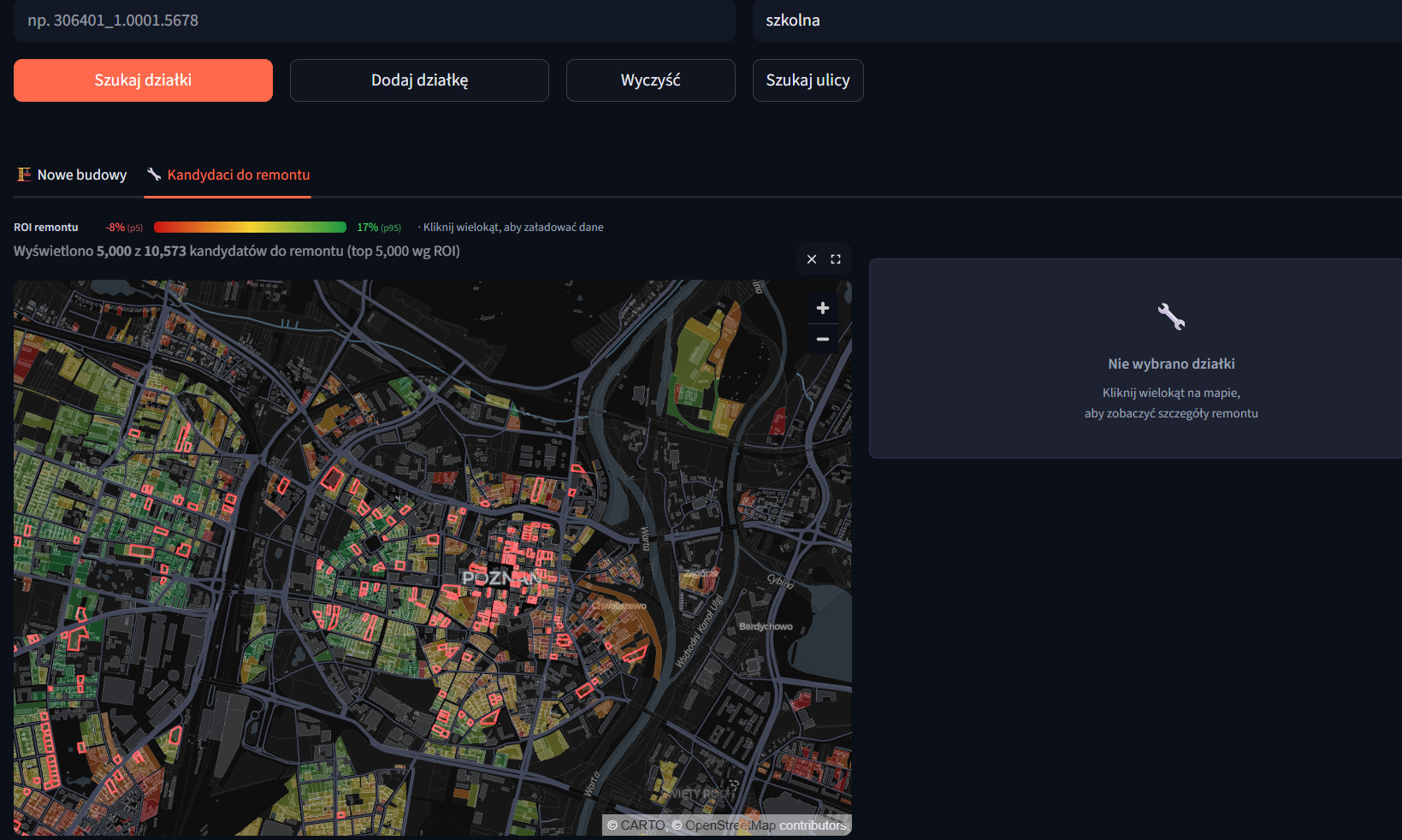
Finds the parcels where redevelopment economics and planning constraints actually align — infill, rebuild, reuse. A city-scale screening engine (over 70k parcels) that runs a full developer financial model — build, demolition, parking, financing, projected revenue — on every parcel simultaneously, then surfaces ROI-ranked candidates on a live map. 7 scenarios to choose, quick boot time under 90s. Live MPZP zoning overrides, heritage cost multipliers, registered transaction comparables, and an engineered parking-capacity model baked into every result. Transferrable to any polish city.
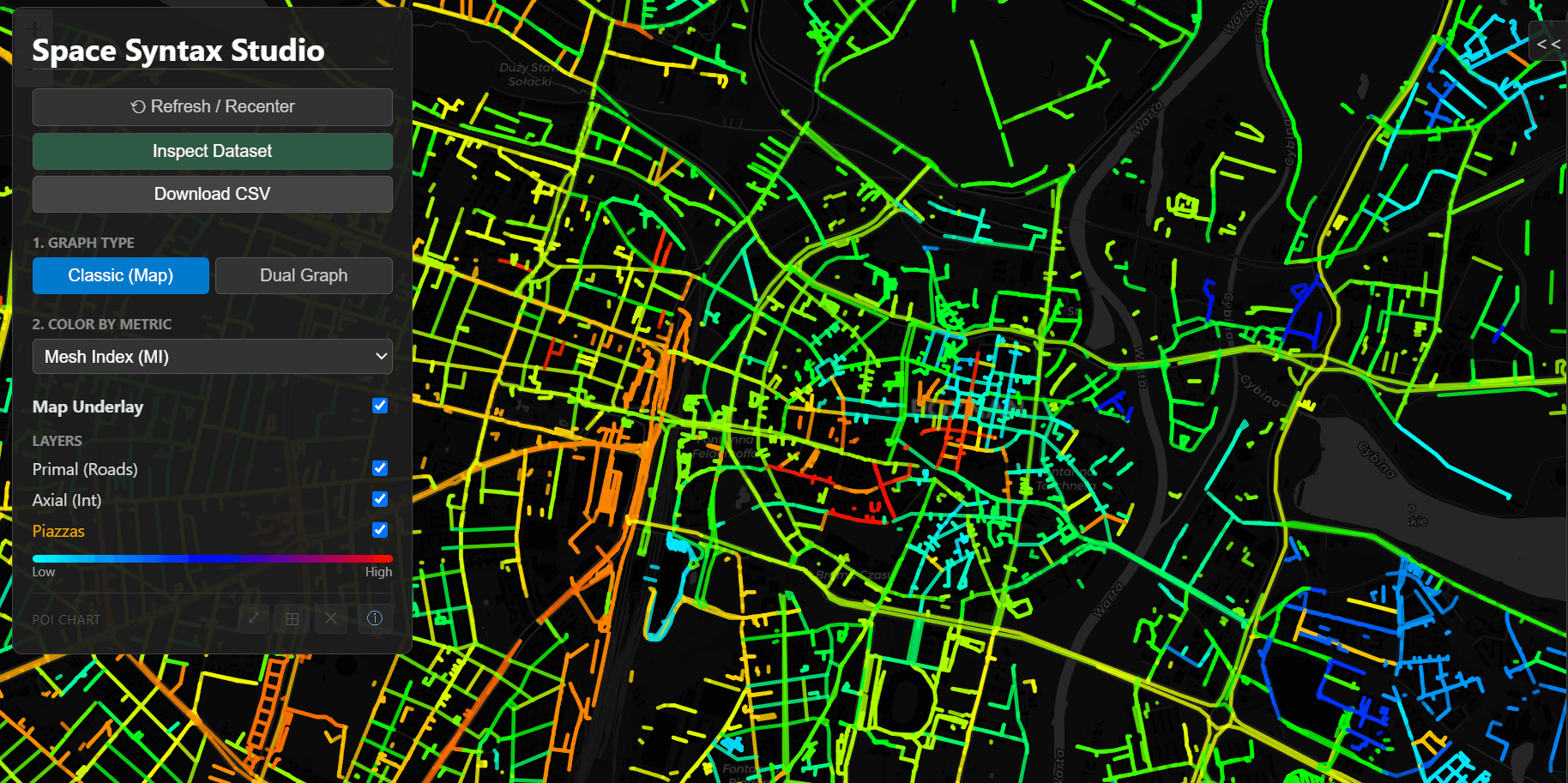
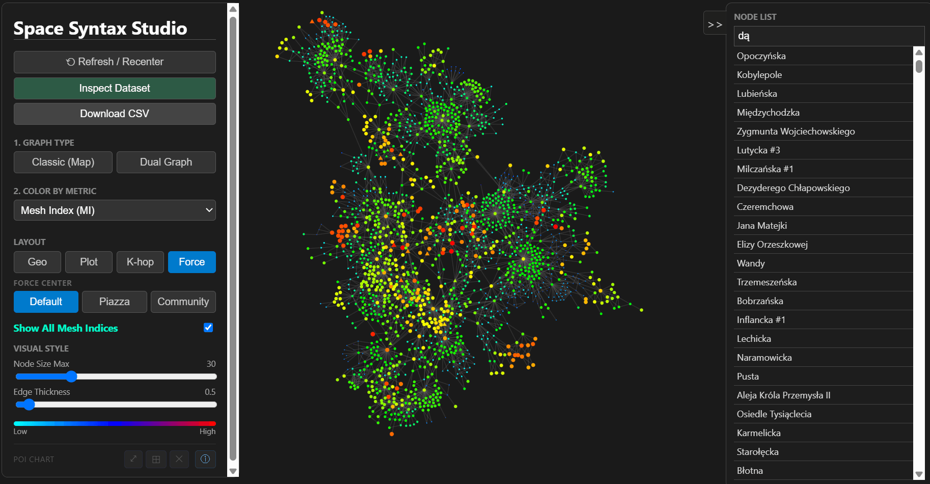
Interactive urban-network analysis implementing the original Mesh Index metric alongside classical space-syntax measures — axial integration, choice, spatial entropy, piazza detection. Switches between geographic and topological views across primal and dual graph representations.
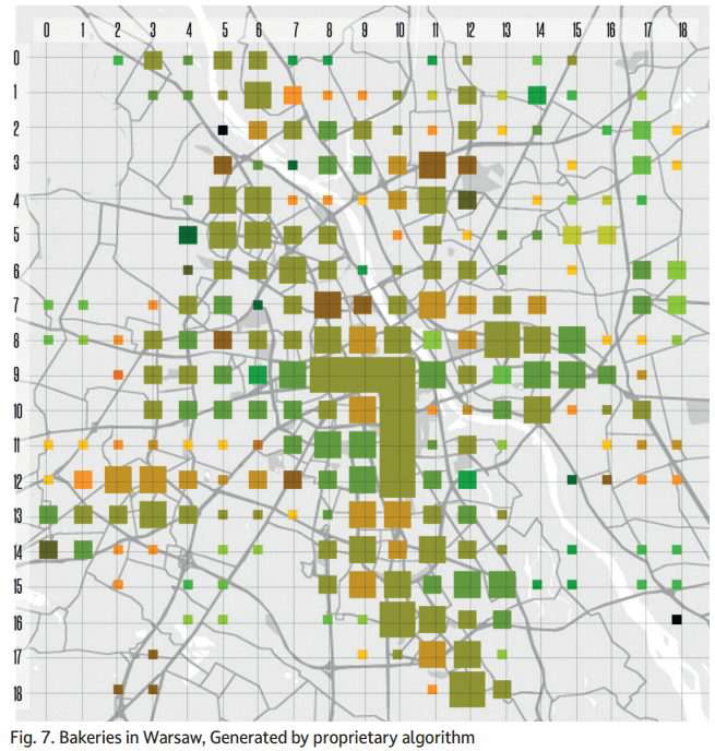
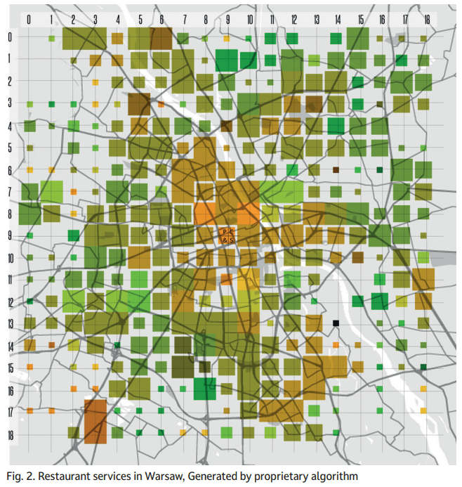
A proprietary algorithm for analysing the spatial distribution of urban services across a city's lattice by keyword — based on urban-platform big data. Hue encodes quality and price accessibility; size encodes choice range. Validated against Warsaw in the context of the 15-Minute City framework, published in Builder Science (2024).

Applied research and product studio at the intersection of urban science and real-estate development. Based in Poznań.
Piotr Kamiński, Eng. Arch., PhD — urban scientist, practising architect, strategic consultant obsessed with cities. Mesh Index originated in PhD research on network-society spatial analysis.